Discover the History and Beauty Near Plas Weunydd
walks
history & routes
Barlwyd Shepherd's Huts are located near Barlwyd Dams that were built to extract slate from the Llechwedd Slate Mine. The two dams, Barlwyd Mawr and Barlwyd Uchaf, were initially used to power water wheels and, later, water turbine generators. Today, Barlwyd Mawr provides up to 360kW of green energy to the National Grid. Barlwyd Uchaf is only used for fishing.
We’ve created a Strava Club for our team and our guests to share their favourite routes in the area. Have a look at our Strava here!
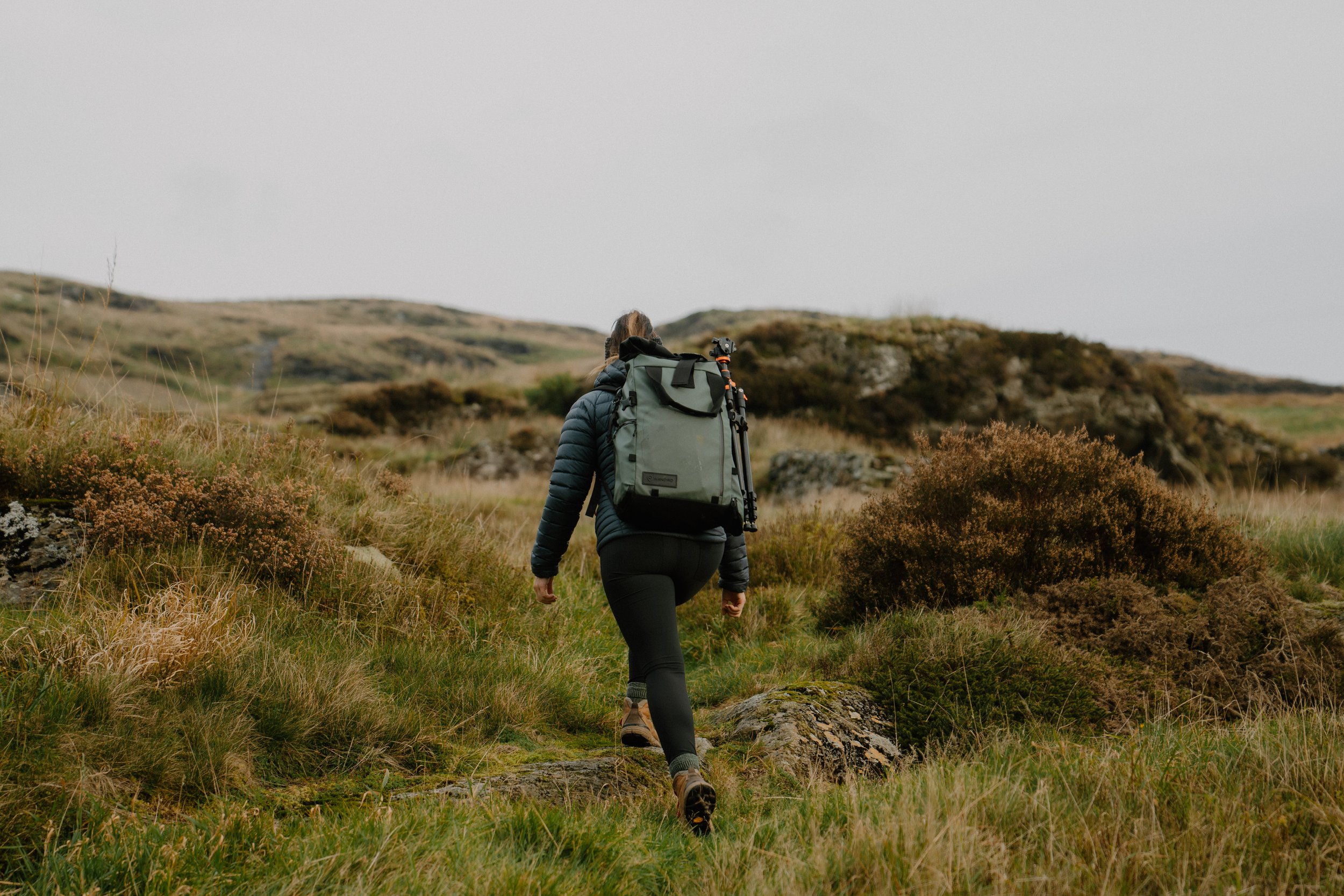
We’ve also created three tailor-made walking guides that you can start right from your Shepherd’s Hut. You can choose from three different walks, each with varying difficulty levels. Walk 1 is the easiest, and Walk 3 is the most challenging. You can download the routes for all three walks below.
We’ve also collected some of our favourite walks in the area, which you can also find below.
If you’d like a guided walk to discover some hidden gems in Eryri, check our Events page.
THREE WALKS FROM BARLWYD

walk 1 - Easy
-
7km Return
-
This linear walk takes you from your hut to either Plas Weunydd or to Llyn Fridd, a reservoir. On the way, you will get good views down the valley and see the largest slate mine in the world.

walk 2 - Intermediate
-
10km Circular Walk
-
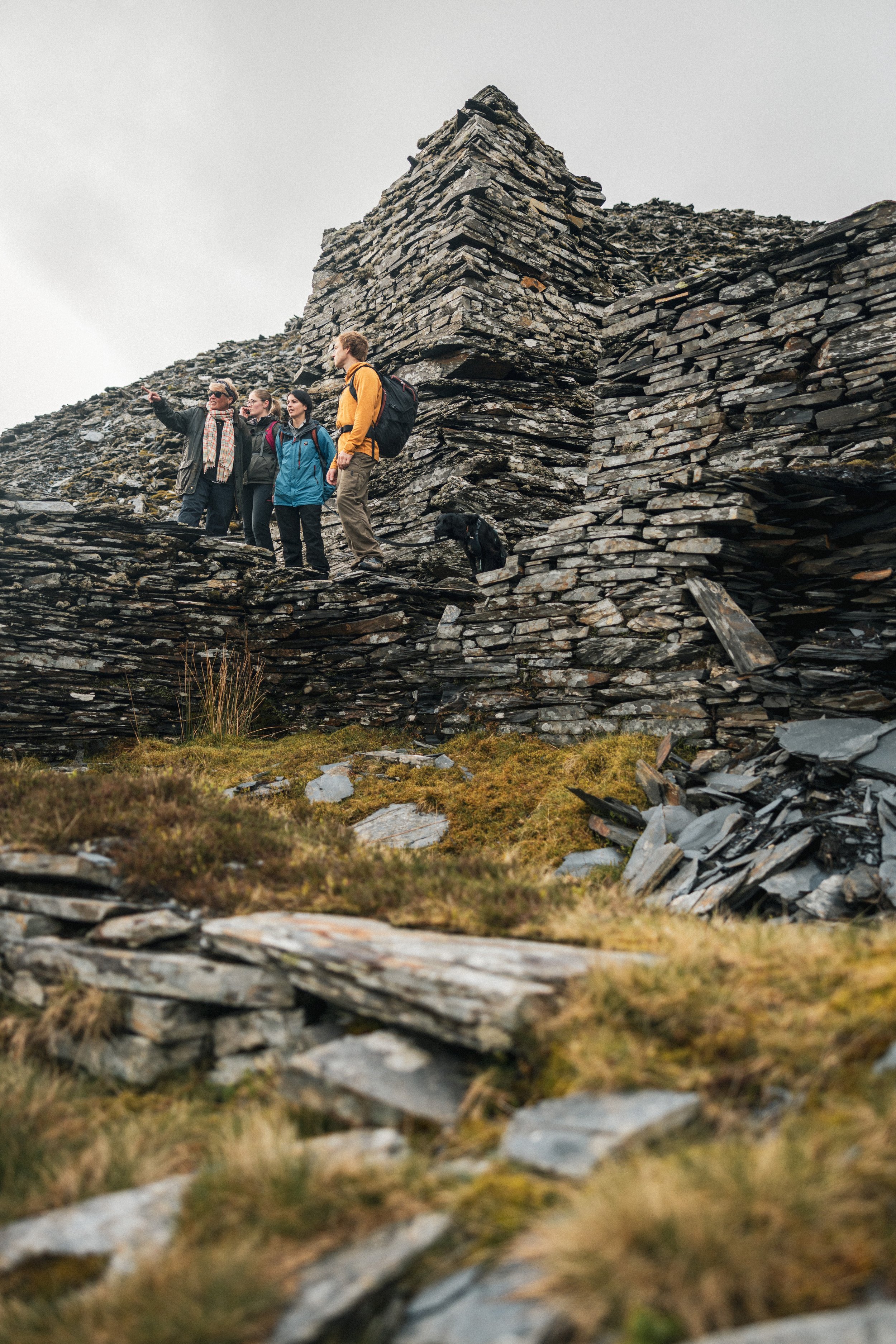
This walks takes you to the long abandoned Rhiwbach Quarry which, due to its remoteness, still has buildings and the remains of a village. On the way you will pass beside two of our reservoirs in a very unspoilt area and will often see nobody at all. On the return you go through Diffwys Quarry, the original quarry in Blaenau Ffestiniog, and on a good day can look all the way down the valley to the sea.

Walk 3 - Challenging
-
Circular Walk starting from the huts is 21km
-
This is aimed at more experienced walkers who are used to navigating by map and compass and crossing pathless terrain. Consequently fewer details are provided and the reader will need to select routes based on the map, their experience, and the weather. Moel Penamnen is the obvious hill looking down on all the huts and its summit at 614m (2014ft) gives far reaching views.
favourite nearby Walks
Experience the beauty and history of the area surrounding Plas Weunydd. Here is a selection of some the incredible walks only a short distance away.
You’ll find a printable PDF of each to download. These maps are meant to be suggestions, please be sure to bring along a map such as an OS Map (you may be able buy these in the bookshop in Blaenau Ffestiniog), a compass and a well-charged phone!
Moderate - Involves some uphill walking, but easily managed by a reasonably fit person.
Strenuous - Some long or steep uphill sections, but okay for a reasonably fit person.
-
A varied 1 1/2 mile walk which takes you past Tanygrisiau Reservoir, then to a footbridge over the Afon Cwmorthin from where you can see the dramatic waterfalls on the river. The Cwmorthin flows into the reservoir to the south of which are the Rhinog mountains.
-
A 3 mile walk which crosses the Afon Dubach then explores the lower reaches of the Bowydd valley. It passes the quiet settlement of Tan y Bryn then returns through woodland to cross the Dubach river once more. Allow 2½ hours.
-
A dramatic 3-mile walk climbing from Tanygrisiau past magnificent waterfalls into a spectacular valley which was once a centre of slate quarrying. You follow an old tramway past Llyn Cwmorthin to a ruined chapel and the remains of a mining settlement.
-
This 2-mile walk climbs high above Tanygrisiau, passing through tunnels under the Ffestiniog Railway. It provides magnificent views of the Moelwyn mountains and takes you twice over the fast-flowing Barlwyd river.
-
A 4-mile walk which uses tracks and disused inclines to take you past towering spoil-heaps to some wonderful viewpoints, from where Yr Wyddfa (Snowdon) and many surrounding mountain peaks can be seen.
-
This 4½ mile walk explores the wild mountain landscape above Blaenau Ffestiniog. It visits remote lakes and passes disused inclines once integral to Blaenau’s world-famous slate industry
-
This 3-mile walk provides wonderful views both of the reservoir and of the Moelwyn mountains above it. The walk also crosses the Ffestiniog Railway on four occasions.